Employment Technical Paper [EXAM 112]
7. Appendices
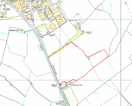
7.1. New Spring Farm Site Assessment
Site Assessment Framework for Strategic Employment Sites[1]
|
Site Details |
||||
|
Ref No |
NLP067 |
|||
|
Site Name |
Land at New Spring Farm, Biggleswade |
|||
|
Site Address |
New Spring Farm, Biggleswade, SG18 |
|||
|
Settlement |
Biggleswade |
|||
|
Size |
Submitted Developable Area: 31.97Ha Submitted Whole Site Area: 31.97Ha Measured GIS Area: |
|||
|
Proposed Use |
Employment |
|||
|
Additional Info |
Site submitted for residential development (approximately 500 dwellings) and/or retirement living. Site identified as having potential to also form an extension to the existing business park at Stratton, including B1, B2 and B8 Uses. Identified that other land uses could be considered for an allocation. |
|||
|
Map |
|
|||
|
STAGE 1: SUITABILITY AND AVAILABILITY (EXCLUSIONARY STAGE) This section will exclude any sites which do not pass the exclusionary suitability criteria and they will not be assessed further. |
||||
|
STAGE 1A ASSESSMENT This stage of the assessment rules out sites that are too small or conflict with national policy designations. |
||||
|
Provisional Site Capacity |
||||
|
1 |
Does the submitted Developable Area indicate that the site is likely to accommodate less than 40,000Sq/m of floorspace?[2] |
No |
The site could accommodate 40,000sqm employment |
|
|
Flood Risk (All sites which reach Stage 2 will be subject to the Sequential Test) |
||||
|
2 |
Is more than 50% of the site located in Flood Zone 2 or 3? |
No |
Site not within Flood zone 2 or 3. |
|
|
3 |
Is more than 50% of the site at risk from surface water flooding? |
No |
Site not at risk from surface water flooding |
|
|
Nationally significant designations (All sites which reach Stage 2 be subject to detailed assessment) |
||||
|
4 |
Is more than 50% of the site covered by nationally significant designations? These are: Sites of Special Scientific Interest, National Nature Reserves, Scheduled Monuments, Registered Parks and Gardens. |
No |
No nationally significant designations on site. |
|
|
5 |
Is more than 50% of the site located within the Area of Outstanding Natural Beauty? |
No |
The site is not within an AONB |
|
|
Does the site continue to the next stage (yes answers to questions 1, 4, or 5 prevent progression to the next stage)? |
Yes |
|||
|
STAGE 1B ASSESSMENT This stage of the assessment rules out sites that are not able to meet their critical infrastructure needs[3]. Intelligent judgement should be used to assess if the site progresses to the next stage. |
||||
|
Critical Infrastructure |
||||
|
6 |
Can the site meet the critical infrastructure requirements that will enable delivery[4]for employment? |
G |
The site requires the provision of utilities to serve the site; these could be provided as part of the proposal. There will be a requirement for access improvements off the A1 or proposed access through the adjacent Stratton Business Park. |
|
|
Does the site continue to next stage? |
Yes |
|||
|
|
||||
|
STAGE 1C ASSESSMENT This stage of the assessment rules out sites that are not available. A site is considered available for development where there are no legal or ownership problems and the landowner has expressed an intention to develop the site. Intelligent judgement should be used to assess if the site progresses to the next stage. |
||||
|
Availability |
||||
|
7 |
What is the existing use of the site? Would the existing use limit the development potential? |
G |
Arable land |
|
|
8 |
Is the land controlled by a developer or land owner who has expressed an intention to develop the site? |
G |
Land controlled by land owner intent on developing the site. |
|
|
9 |
Are there any legal or ownership problems that could delay or prevent development? If Yes, can these issues realistically be overcome? |
G |
No legal or ownership problems. |
|
|
10 |
Does the site already have planning permission for the proposed use?[5] |
G |
No planning applications or permissions |
|
|
Does the site continue to next stage? |
Yes |
|||
|
STAGE 1D ASSESSMENT Consultants will evaluate each site which lies within the Green Belt in terms of how it meets the five purposes of Green Belt. This section records the findings of the Strategic Green Belt Review. Intelligent judgement should be used to assess if the site progresses to the next stage. |
||||
|
Greenbelt |
||||
|
11 |
Is the site located within the Green Belt? |
No |
The site is not covered by the green belt |
|
|
12 |
If answer to question 11 is yes, then does the site lie within one of the parcels which have been identified in the Central Bedfordshire and Luton Green Belt Study as making only a relatively weak, weak, or no contribution? |
N/A |
N/A |
|
|
13 |
Are there any identified merits to the site or proposed use that may outweigh the harm to the Green Belt and which may contribute to identification of exceptional circumstances? |
N/A |
N/A |
|
|
Does the site continue to next stage? |
Yes |
|||
|
STAGE 2: SUITABILITY (DETAILED ASSESSMENT) |
|||
|
STAGE 2A ASSESSMENT This stage further assesses the site's suitability using detailed desktop assessment. A red rating for any question does not mean that the site will be automatically excluded at this stage as the ratings across Stage 2 will be looked at as a whole using planning balance. |
|||
|
Previously Developed Land |
|||
|
14 |
Is the site Previously Developed Land in accordance with the NPPF definition?
|
R |
The site is 100% Greenfield land. |
|
Community |
|||
|
15 |
Neighbourhood Planning (only applicable in designated areas) Is the site identified as an employment allocation in an emerging Neighbourhood Plan? |
N/A |
The site is not located within a designed Neighbourhood Planning area. |
|
16 |
Community Consultation Has any community consultation taken place? If yes, provide brief details on the form this consultation took and any overall community response. |
No |
No known community consultation. |
|
Physical Constraints |
|||
|
17 |
Are there any physical constraints or permanent features which would mean that less than 40% of the site was developable? For example, pylons, gas works, sewage treatment works, topography or wind turbines. |
G |
No physical constraints. |
|
Relationship to Settlements |
|||
|
18 |
Not applicable for sites which adjoin Significant Facilities in the Countryside[6]. Would development of the site be complimentary to the existing settlement pattern and would it have a negative impact on any historic unique or distinctive characteristics of the settlement's built or natural form? |
A |
The site would extend Biggleswade south, beyond the existing settlement pattern. |
|
Agricultural Land Quality |
|||
|
19 |
Would the development impact on high quality agricultural land?
|
R |
Grade 2 |
|
STAGE 2B ASSESSMENT This stage further assesses the site's suitability using comments from technical specialists. Intelligent judgement should be used to assess if the site progresses to the next stage. Answers to Q's 25 – 33 will be supplied by CBC. |
|||
|
Transport and Access to Services |
|||
|
20 |
Distance to Town centre/ Local Centre:
|
A |
2-5km to Biggleswade town centre |
|
21 |
Distance to bus stops with a frequent service:
|
R |
Over 800m |
|
22 |
Distance to nearest train station:
|
R |
Site over 1200m from railway station |
|
23 |
What is the site's proximity to the Strategic Road Network (M1, A1, A421, A5) and Local Road Network (e.g. A6, A507) |
G |
The site is adjacent to the A1 |
|
Drainage and Flooding (All sites subject to Sequential Test) |
|||
|
24 |
What is the conclusion of the sequential approach to site allocations, in regards to flood risk? |
A |
OW present, JFlow modelling required to confirm flood risk |
|
Environmental Health |
|||
|
25 |
Contamination Are there any contamination constraints on site and will there be any remediation required? |
A |
Unknown |
|
26 |
Adjoining uses Would any adjoining uses have the potential to cause conflict with the proposed use? (for example; noise and smell) |
G |
Adjoining use is employment |
|
Environmental Constraints |
|||
|
27 |
Landscape character What would the impacts of development be on the landscape character or setting of the area or any designated landscapes? Would there be any direct or indirect harm to the Area of Outstanding Natural Beauty or the Nature Improvement Area? |
R/A |
Open, arable landscape forming rural setting to town. Maturing screen buffer to north contains existing development. Concern regarding visual impact on countryside to south and east ,also impact on isolated cottages . Scope for mitigation in scale with development but site would unacceptably extend urban form into rural vale. |
|
28 |
Heritage/ Archaeology What would the impacts of development be on any heritage or archaeological assets and their setting? Are there any opportunities for enhancement of these assets? |
A |
Site has archaeological potential, but this would not prevent allocation providing appropriate mitigation is undertaken. |
|
29 |
Ecological Assets What would the impacts of development be on any biological, geological or ecological assets and are there any opportunities for their enhancement? |
A |
Potential impact on farmland species |
|
30 |
Open space/leisure and GI assets Are there any potential conflicts with open space or leisure designations? |
G |
RoW on eastern edge. No aspirations identified in Parish GI plan. No loss of leisure. |
|
Minerals and Waste |
|||
|
31 |
What would the impacts of development be on safeguarded minerals and waste sites, including mineral safeguarding sites? |
G |
No Issues |
|
Planning History |
|||
|
32 |
What is the sites planning history? (For example planning applications and submissions to previous Allocations Plans) |
No other relevant planning history. |
|
|
Does the site continue to next stage? |
Yes |
||
|
STAGE 2 ASSESSMENT CONCLUSION |
|||
|
This site is suitable for the proposed development, and therefore it passes stage 2. It is located alongside the A1 and is in a strategic location for a new development. There are some issues in terms of landscape, archaeology and ecology and the impact on agricultural land. With appropriate mitigation, the issues could be overcome. |
|||
|
STAGE 3: AVAILABILITY The section assesses the availability of the site; a viability assessment will be carried out on a shortlist at a later stage. |
|||
|
Achievability |
|||
|
33 |
When can the scheme realistically commence delivery? • 0 to 5 years (deliverable) • 6 to 10 years • 11 to 15 years • 15 to 20 years • Outside Plan Period |
0 – 5 years Site promotors identify site is available now. |
|
|
34 |
Considering the size of the site, what is the indicative build out time? |
5-10 years |
|
|
35 |
What is a realistic timeline for the deliverability of the site? Short (0-5 years), medium (5-10 years), or long (10-15 years)? |
Medium term (5-10 yrs) |
|
|
Market Signals |
|||
|
36 |
Are there any market factors which would affect deliverability? |
G |
There are no market factors which would negatively affect deliverability on this site |
|
37 |
What is the extent and success of similar developments in the market area? Is there an over/under supply? |
G |
Along the A1 corridor surrounding Biggleswade there is a strong presence from local industrial estates and offices, including Albone Way and Eldon Way Industrial Estates, and Stratton Business Park. There are expansion plans for Stratton Business Park, suggesting demand for this type of office/industrial use in the area. There is also a relatively strong market for offices within Biggleswade town centre. |
|
38 |
Assuming 'normal' market conditions, if the site is offered to the market for its proposed employment use will it be successfully developed and occupied? |
G |
Market signals suggest that this this location would be well suited to local office and industrial uses, similar to those along the A1 corridor. |
|
Does the site pass this stage? |
Yes |
||
|
SUMMARY – to inform the summary spreadsheet |
|||
|
Does the site pass the assessment? |
Yes |
||
|
Market signals suggest that this site would be suited to local office and industrial uses, similar to others along the A1. |
|||
|
The sites that pass through this assessment process will not automatically be allocated for development in the Local Plan. Sites will be selected with reference to:
|
|||

[1] Strategic Sites are considered to be those that are either standalone sites or extensions to existing employment areas that would result in a minimum of 10ha being allocated and are likely to meet demand arising within and beyond the immediate area. Sites of less than 10ha are not being considered for employment allocations at this stage.
[2] Use a plot ratio of 40%.
[3] Critical infrastructure is that which has been identified as infrastructure that must happen to enable physical development. These infrastructure items are often known as 'blockers' or 'showstoppers', and are most common in relation to transport and utilities infrastructure. Failure to provide these pieces of infrastructure could result in significant delays in the delivery of development.
[4] This is an assessment based on the information known at this stage, a full assessment of infrastructure requirements will be undertaken before any sites are allocated.
[5] Answers should be based on the criteria of: Red = Planning app for the proposed use; Amber = Planning app, but not for the proposed use; and, Green = No planning app
[6] Significant Facilities in the countryside include Cranfield University and Technology Park, Shuttleworth College, Millbrook Proving Ground, RAF Henlow, DISC Chicksands, ZSL Whipsnade, Woburn Safari Park, Toddington Motorway Services Area, Faldo Road Industrial Estate in Barton-le-Clay, Center Parcs and Lockhead Martin Ampthill.
[7] The RAG conclusion relates to the sequential approach, e.g. if green – take forward, if amber - consider further assessment, if red – further assessment needed (L2).
The exact wording may change slightly but the approach should remain the same.


