Validation Guide: A guide to submitting Planning Applications (National and Local Requirements)
6.0 Drawings and Plans – National List Requirements
6.1 All submitted plans should be in the following format and must include the following detail:
- a pdf format when submitted electronically
- plans should be drawn to a metric scale
- each plan/drawing needs to include a plan description title, for example existing rear (south) elevation.
- a scale bar indicating the scale of the drawing must be included along with confirmation of the scale of the drawing
- plans/drawings should not contain disclaimers such as "Do not Scale", "Not to Scale", "Draft" – submission of drawings including these disclaimers or similar will be considered invalid.
- individual files should be no bigger than 30Mb in size.
6.2 Location Plan
6.2.1 This is to show us where the site is and the land to which the application relates. The National Planning Practice Guidance provides information on what information should be included on a location plan
6.2.2 The following requirements apply to a location plan:
- up to date OS based map
- appropriate scale 1:1250 or 1:2500
- include a scale bar
- scale must be included in writing on the drawing
- clearly mark the direction of north
- show the full site, all site boundaries and adjoining properties
- outline in red – all the application site boundaries and all necessary land required to carry out the development, including any land required for access to the site from the highway
- outline in blue - any other land within your ownership or control adjacent to the site
- show authorised copiers licence number with appropriate copyright acknowledgements
- not a Land Registry Document/ plan (copyright issues)
6.2.3 Please note that copying Ordnance Survey maps without a valid licence is a breach of Ordnance Survey copyright.
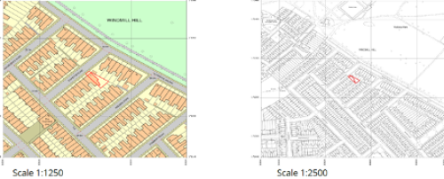
6.2.4 Examples of location plan
6.3 Proposed Site Plan/ Block Plan
6.3.1 This is a large-scale plan view of the site. It shows the details of the site and the proposal indicated in relation to neighbouring properties.
6.3.2 Block/ Site Plan requirements:
- up to date OS based map
- appropriate scale 1:500 or 1:200
- include a scale bar
- scale must be included in writing on the drawing
- clearly mark the direction of north
- the red edge of the site shown on the site/ block plan must match the location plan submitted
- show the full site, all site boundaries, existing buildings, roads, footpaths, neighbouring properties and proposed boundary treatments
- identify any buildings to be removed
- include access arrangements where relevant to the proposal – access width, vision splays, existing and proposed vehicle parking provision and cycle parking
- clearly and accurately show the position of existing trees and hedges, including those that could be affected by the development and identify those that are proposed to be removed
6.3.3 Further guidance on what is required for a location plan and site/block plan can be found on the Planning Portal.
6.4 Existing and Proposed Elevations
6.4.1 These drawings are required so we can accurately see the proposed development in relation to the existing situation.
6.4.2 Elevations are drawings, which show the front, sides and/ or rear of a building or structure.
6.4.3 The existing elevations will show the building or structure as it currently is.
6.4.4 The proposed elevations will show the changes to the building or structure.
6.4.5 An elevation plan must:
- be clearly labelled with site address and identify whether existing or proposed
- be drawn at an identified measurable scale of 1:100 or 1:50 and include a scale bar
- each elevation must be clearly marked with the direction. For example, south elevation or west elevation
- show all elevations in full unless otherwise agreed
- include proposed building materials, style, and finish of the building along with window, door and rainwater goods details or state 'match existing' if no change.
- include a drawing number/ reference
6.5 Existing and Proposed Floor Plan
6.5.1 Floor plans are drawings that show the inside of a building or structure with a view from above. They indicate the different rooms, spaces and other physical features at each level of the building.
6.5.2 A floor plan must:
- be drawn at an identified measurable scale of 1:100 or 1:50 and include a scale bar
- be clearly labelled with site address and identify whether existing or proposed
- Include all external floor measurements
- clearly show the changes (you can use colour to do this)
- show any walls or existing buildings to be demolished
- show openings, such as windows and doors
- show the necessary floor, not just the extension
- include a drawing number/ reference
- include original paper size.
6.6 Existing and Proposed Roof Plan
6.6.1 A roof plan is required where there are changes/ alterations proposed to the roof form.
6.6.2 A roof plan must:
- be drawn at an identified measurable scale of 1:100 or 1:50 and include a scale bar
- show the position of all ridges, valleys, dormer openings, rooflights and other features
- include a drawing number/ reference
6.7 Existing and Proposed Site Sections and finished floor and site levels
6.7.1 These plans are required for all applications where there are changes being made to the existing ground levels. This could be for example where there is a sloping site, or where there are differing ground levels across the site and/or between neighbouring properties.
- Site section plans must:
- be drawn at an identified scale of 1:200, 1:100 or 1:50 and include a scale bar
- show an existing and proposed cross section through the building(s)
- provide details of existing and proposed levels and any retaining walls in relation to an off-site fixed datum point
- show the proposal in relation to adjoining/ neighbouring properties
- include a drawing number/ reference


