Proposed Modifications to Policy Maps
3. Important Countryside Gaps
The following maps illustrate the proposed modifications being made to the Important Countryside Gaps as they appear on the Policies Map.
Modifications to Proposed Important Countryside Gaps
PM9
Site
CG2: Land South of Sutton
Proposed Modification
Removal due to proposed removal of Future Growth Location
Inset Map Location
Sutton
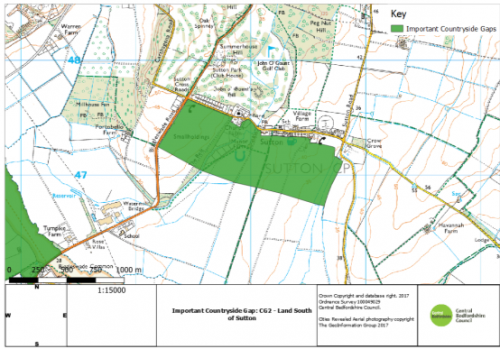
As submitted
Proposed Modification
PM10
Site
CG3: Land North-West of Dunton
Proposed Modification
Removal due to proposed removal of Future Growth Location
Inset Map Location
Dunton
As submitted
Proposed Modification
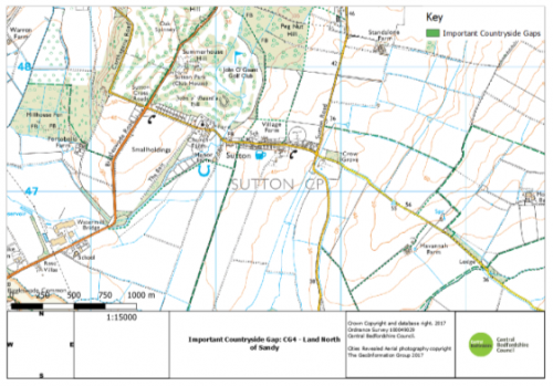
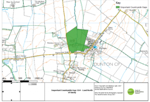
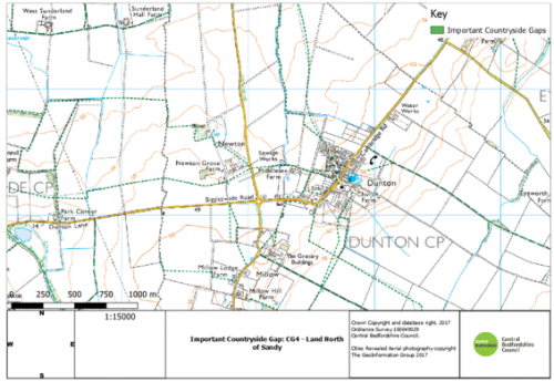
PM11
Site
CG4: Land North of Sandy
Proposed Modification
Removal due to proposed removal of Future Growth Location
Inset Map Location
Sandy
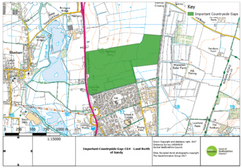
As submitted
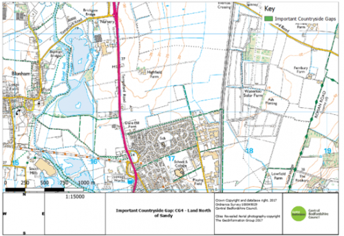
Proposed Modification
PM12
Site
CG6: Land West of Aspley Guise
Proposed Modification
Removal due to proposed removal of Future Growth Location
Inset Map Location
Aspley Guise
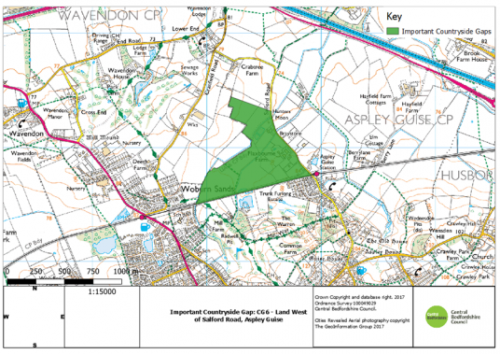
As submitted
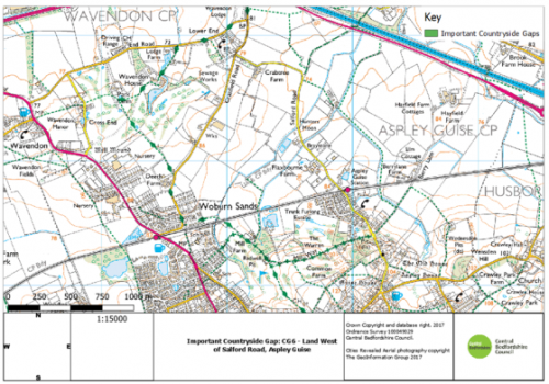
Proposed Modification
PM13
Site
CG18: Land North of Biggleswade
Proposed Modification
Removal as not required
Inset Map Location
Biggleswade
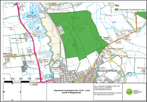
As submitted
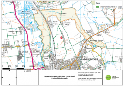
Proposed Modification
PM14
Site
CG19: Land at Tempsford
Proposed Modification
Removal due to proposed removal of Future Growth Location
Inset Map Location
Tempsford
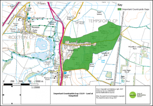
As submitted
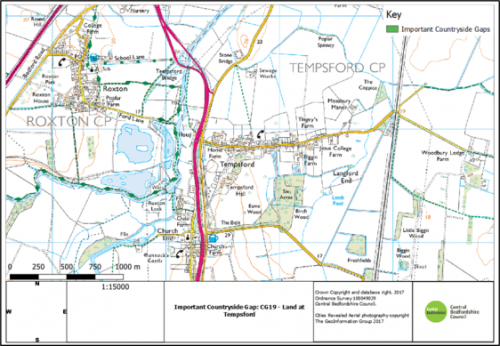
Proposed Modification


