Proposed Modifications to Policy Maps
10. Changes to previously proposed Green Belt boundaries
The following maps illustrate the proposed modifications being made to the Green Belt in comparison to the plan as submitted as they appear on the Policies Map. Please also refer to the 'Green Belt Changes resulting from Central Bedfordshire Local Plan January 2021' document (EXAM132).
Modifications to Policy Maps – Permitted Development Green Belt Changes
PM74
Site
Chaul End
Proposed Modification
Retain site within the Green Belt.
Chaul End Permitted Development. The first map shows the site being removed from the Green Belt, as per the submission Local Plan April 2018. The second map shows the existing status (with the site included in the Green Belt) that is now proposed to remain to be the case (i.e. with the site remaining in the Green Belt) January 2021.
Inset Map Location
Caddington
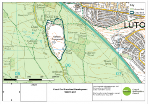
As Submitted
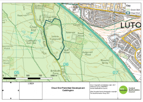
Proposed Modification
PM75
Site
Proposed Modification
Remove sites from within the Green Belt.
Inset Map Location
Sundon

Current Green Belt Status

Proposed Modification
PM76
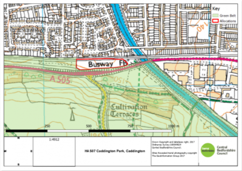
Site
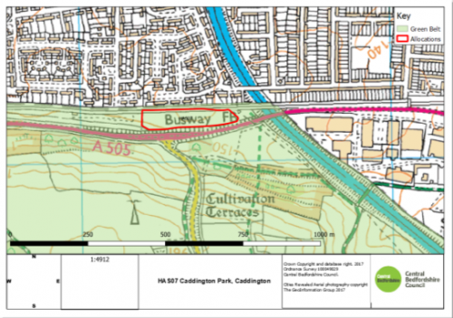
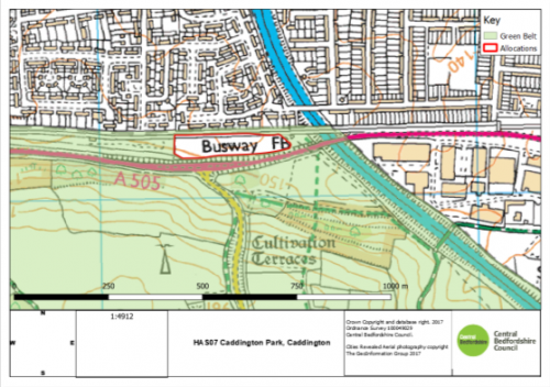
HAS07 Caddington Park
Proposed Modification
Removes site from within the Green Belt and amends Green Belt boundary to remove section east of site
HAS07 Caddington Park: The first map shows the existing status (with the site included in the Green Belt). The second map shows the Proposed Green Belt Change (with the site removed from the Green Belt) as per the Submission Local Plan 2018. The third map shows a further Green Belt change, which the Council is proposing. On reviewing the Green Belt boundary, it was considered the most appropriate boundary would follow the M1 to the east and the allocation boundary to the south and west. The site will connect to the existing housing to the north.
Inset Map Location
Caddington
Current Green Belt Status
As per Submitted Plan
As proposed to be Modified


