Proposed Modifications to Policy Maps
4. Small and Medium Allocations
The following maps illustrate the proposed modifications being made to the Small and Medium Allocations as they appear on the Policies Map.
Modifications to Small and Medium Allocations
PM15
Site
HAS03 Land off Meadow View
Proposed Modification
Site proposed for deletion. Retain Green Belt boundary.
Inset Map Location
Aspley Guise
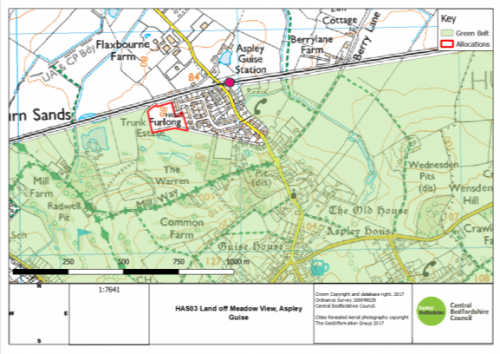
As submitted
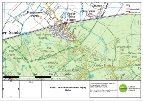
Proposed Modification
PM16
Site
HAS04 Land at Luton Road
Proposed Modification
Site proposed for deletion. Retain Green Belt boundary.
Inset Map Location
Barton-le-Clay
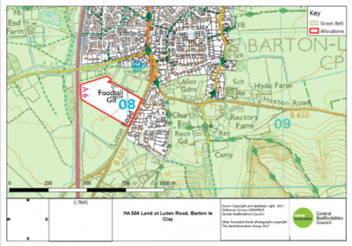
As submitted
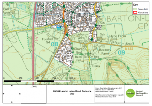
Proposed Modification
PM17
Site
HAS08: Land on the South-East of the Greenway
Proposed Modification
Amend site boundary to reflect correct site area.
Inset Map Location
Campton
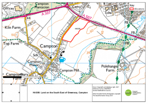
As submitted
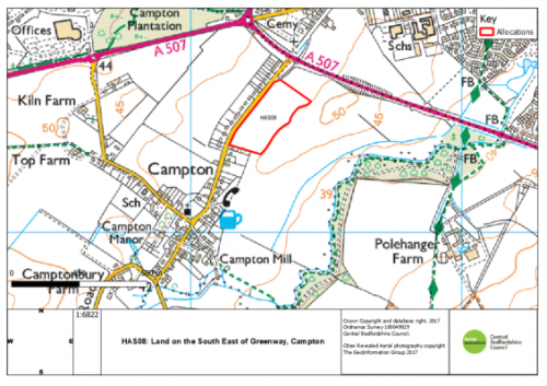
Proposed Modification
PM18
Site
HAS09 Chapel Farm
Proposed Modification
Site proposed for deletion. Retain Green Belt boundary.
Inset Map Location
Chalton
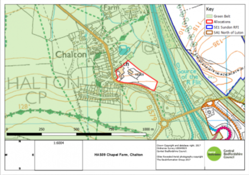
As submitted
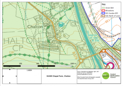
Proposed Modification
PM19
Site
HAS11: East End Farm
Proposed Modification
Amend site boundary to reflect planning application.
Inset Map Location
Cranfield
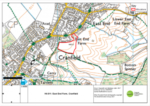
As Submitted
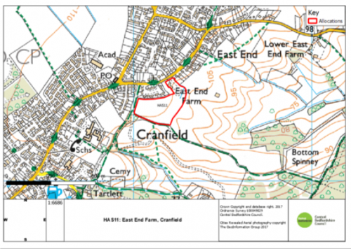
Proposed Modification
PM20
Site
HAS24 Land to the South West of the A5
Proposed Modification
Site proposed for deletion. Retain Green Belt boundary.
Inset Map Location
Hockliffe
As submitted
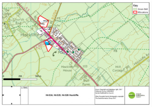
Proposed Modification
PM21
Site
HAS45: Land South and East of High Road
Proposed Modification
Amend site boundary to show smaller proposed site.
Inset Map Location
Shillington
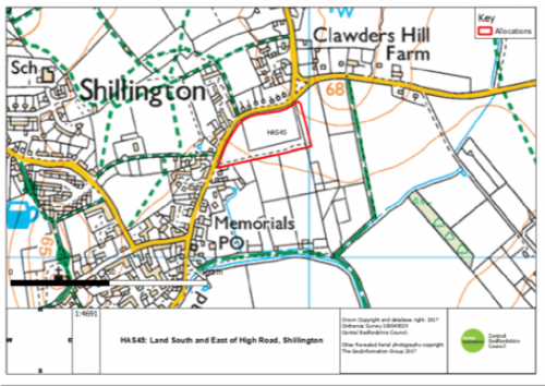
As submitted
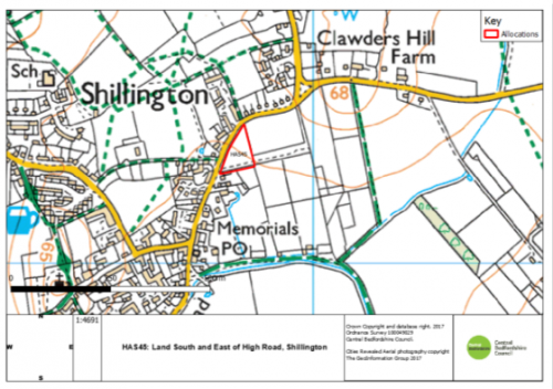
Proposed Modification
PM22
Site
HAS48: Land South of the High Street
Proposed Modification
Amend site boundary to remove woodland.
Inset Map Location
Sutton
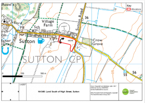
As submitted
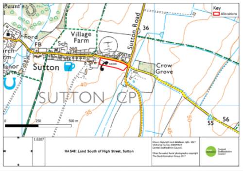
Proposed Modification


