Proposed Modifications to Policy Maps
Ended on the 5th May 2021
7. Modifications to Policy Maps – Open Space Designations
The following maps illustrate the proposed modifications being made to Open Space Designations as they appear on the Policies Map.
Modifications to Policy Maps – Open Space Designations
PM47
Site
HAS18: Steppingley Road Allotments
Proposed Modification
Removal of open space designation
Inset Map Location
Flitwick
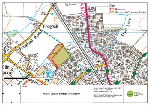
As submitted
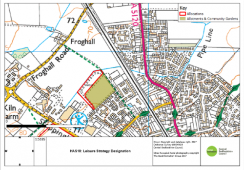
Proposed Modification
PM48
Site
HAS35: Wood End Lane
Proposed Modification
Removal of open space designation
Inset Map Location
Marston Moretaine
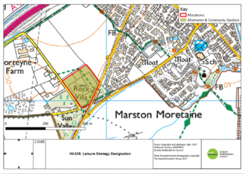
As submitted
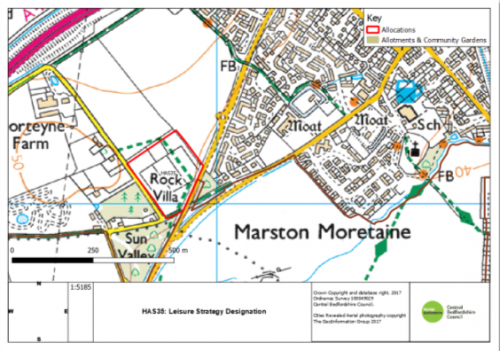
Proposed Modification
PM49
Site
HAS46: Land Rear of Station Road
Proposed Modification
Removal of open space designation
Inset Map Location
Lower Stondon
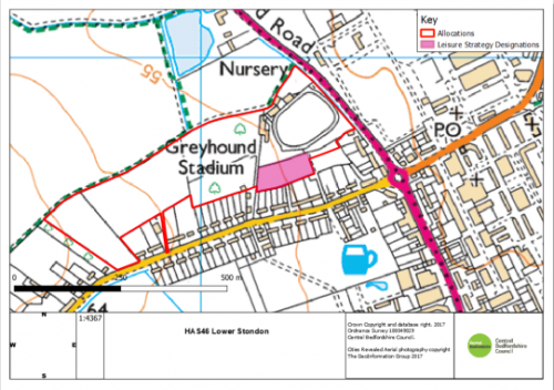
As submitted
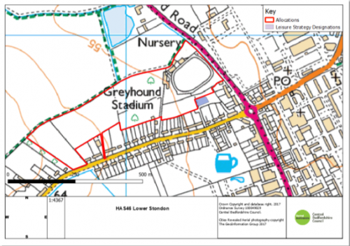
Proposed Modification
For instructions on how to use the system and make comments, please see our help guide.
Share on:


